


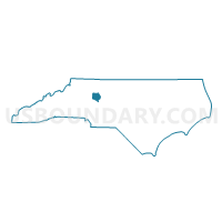
Voting District 12, Davie County, North Carolina
About
Outline

Summary
| Unique Area Identifier | 639905 |
| Name | Voting District 12 |
| County | Davie County |
| State | North Carolina |
| Area (square miles) | 13.96 |
| Land Area (square miles) | 13.87 |
| Water Area (square miles) | 0.09 |
| % of Land Area | 99.37 |
| % of Water Area | 0.63 |
| Latitude of the Internal Point | 35.98305630 |
| Longtitude of the Internal Point | -80.48148450 |
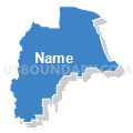
Maps


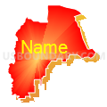
Graphs
Select a template below for downloading or customizing gragh for Voting District 12, Davie County, North Carolina


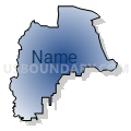

Neighbors
Neighoring Voting District (by Name) Neighboring Voting District on the Map
- Voting District 05, Davie County, NC
- Voting District 11, Davie County, NC
- Voting District 13, Davie County, NC
- Voting District 14, Davie County, NC
Top 10 Neighboring County Subdivision (by Population) Neighboring County Subdivision on the Map
- Farmington township, Davie County, NC (11,313)
- Mocksville township, Davie County, NC (9,837)
- Shady Grove township, Davie County, NC (5,308)